Enterprise Drone &
UAV Solutions
UAV systems, precision sensors, and mission intelligence software, deployed across Malta for survey, inspection, public safety, and precision agriculture.
Ground truth. Digital assets.
Centimetre accuracy.
Professional drone survey platforms paired with UgCS mission planning and Zenmuse LiDAR payloads deliver highly accurate digital deliverables for surveyors, engineers, and planners across Malta's complex terrain.
Land Survey
Quickly generate accurate 2D and 3D models with RTK-corrected photogrammetry. Cover more ground, improve accuracy, and reduce field team costs significantly.
Urban Planning & BIM
Create high-fidelity 3D city models and building information models integrated with GIS platforms. XGrids spatial computing provides actionable digital twin outputs.
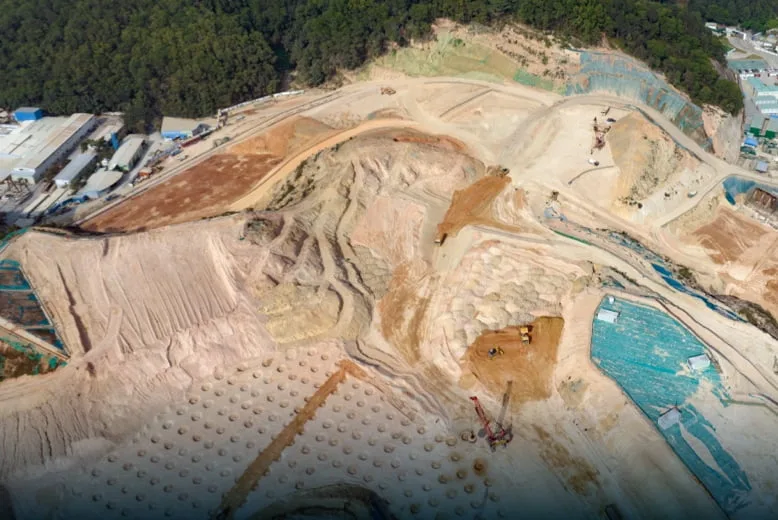
Volumetrics & Mining
Stockpile volume measurement, earthwork calculations, and progress monitoring for quarry and construction operations across the Maltese islands.
Heritage Preservation
Photogrammetric 3D documentation of Malta's UNESCO sites, fortifications, and historic structures, non-invasive and millimetre-resolution.
Drones eliminate
risk in critical inspections.
Drone inspections deliver accurate visual and thermal data of infrastructure with no access risks. Through visual, thermal, and multi-sensor payloads, DJI Enterprise platforms provide targeted maintenance intelligence for Malta's utility, energy, and civil infrastructure.
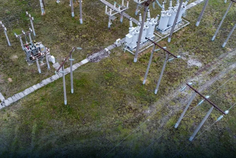
Powerline & Grid Inspection
Autonomous corridor inspection of Enemalta's transmission and distribution infrastructure. Thermal imaging detects hotspots and connection faults before failure occurs.
Bridge & Civil Structures
Close-proximity visual inspection of bridges, retaining walls, and coastal infrastructure. High-resolution imaging captures surface cracking and material degradation without scaffolding.
Solar PV Inspection
Thermal and multispectral scanning of photovoltaic installations identifies faulty cells, delamination, and soiling patterns, enabling targeted maintenance rather than full-farm shutdowns.
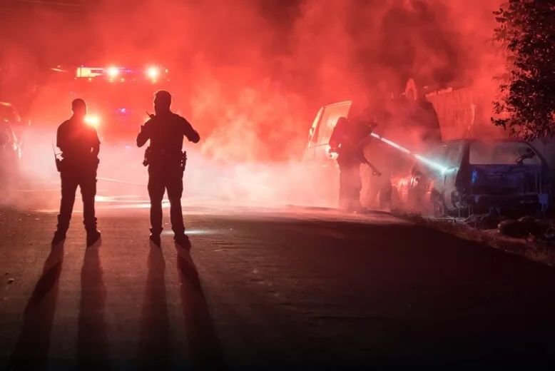
Drones elevate response
times and save lives.
Aerial platforms extend the reach of Malta's emergency services, providing real-time situational awareness, search capability, and incident command intelligence that ground-based teams cannot match.
Search & Rescue
Thermal-equipped UAVs scan coastline, garigue, and open sea simultaneously, detecting heat signatures far faster than any ground team. Operational in under three minutes from a standing start.
Firefighting Support
The Matrice 4T and M30 map fire perimeters in real time using the Zenmuse H30T's thermal and optical sensors. DJI Dock 3 enables autonomous pre-positioned deployment, launching the moment an incident is reported, monitored via FlightHub 2 from the command centre.
Law Enforcement & Security
Real-time situational awareness for events, perimeter control, and incident response. DJI Dock 3 autonomous patrol provides persistent aerial presence without continuous pilot deployment, managed remotely through FlightHub 2.
Smarter farming.
Less inputs. Better yields.
DJI Agriculture platforms reduce pesticide and water consumption through precision aerial application, while multispectral sensors deliver crop health data that drives proactive farm management decisions.
Precision Crop Spraying
The Agras T-Series applies pesticides, herbicides, and fertilisers with uniform coverage at a fraction of the labour and chemical cost of ground-based methods. Active phased-array radar avoids obstacles autonomously, including Malta's characteristic rubble walls and carob trees.
Crop Health Monitoring
Multispectral scanning produces NDVI and NDRE maps that reveal crop stress, nutrient deficiency, and water distribution issues before they're visible to the eye. Enables targeted intervention across Malta's field patchwork.
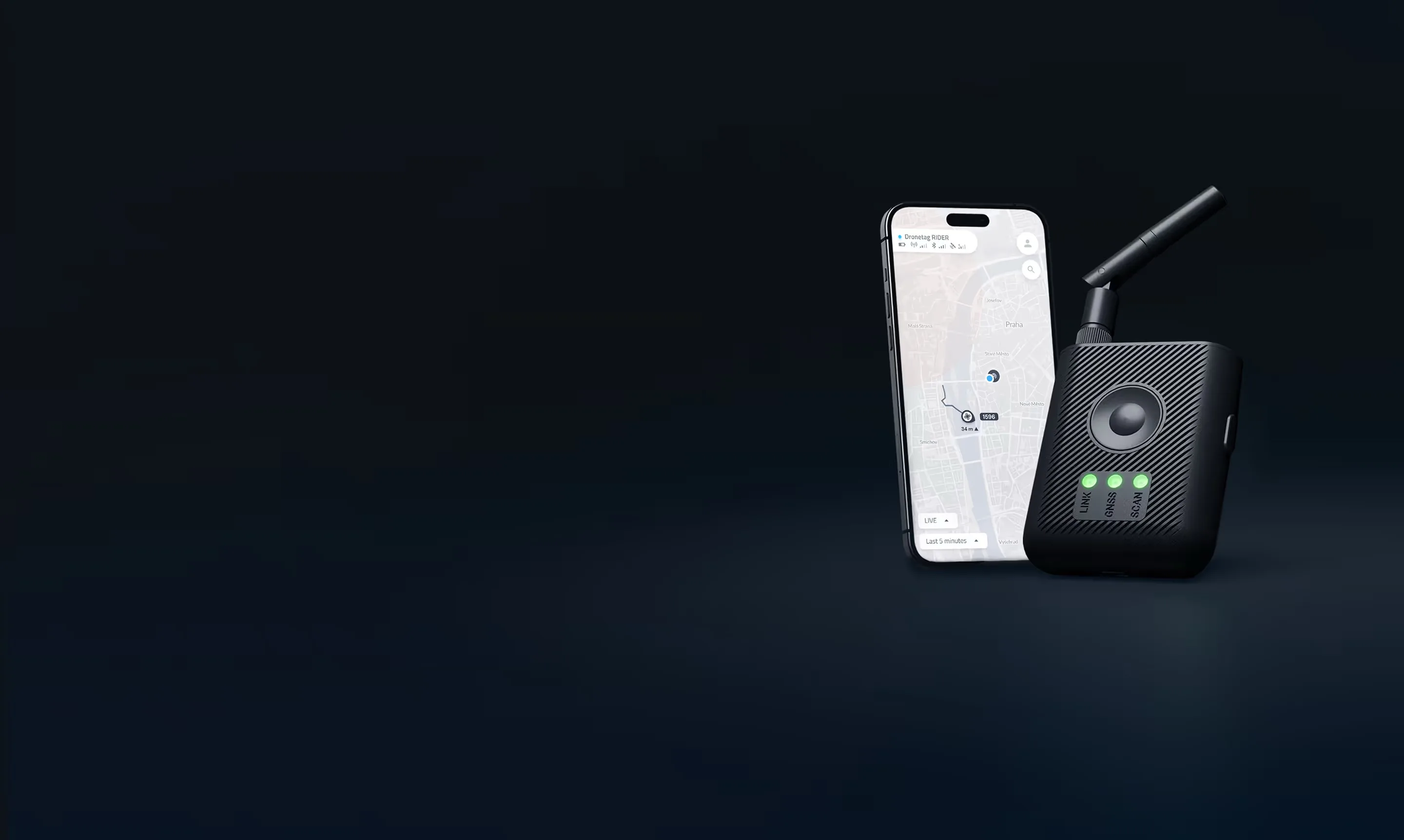
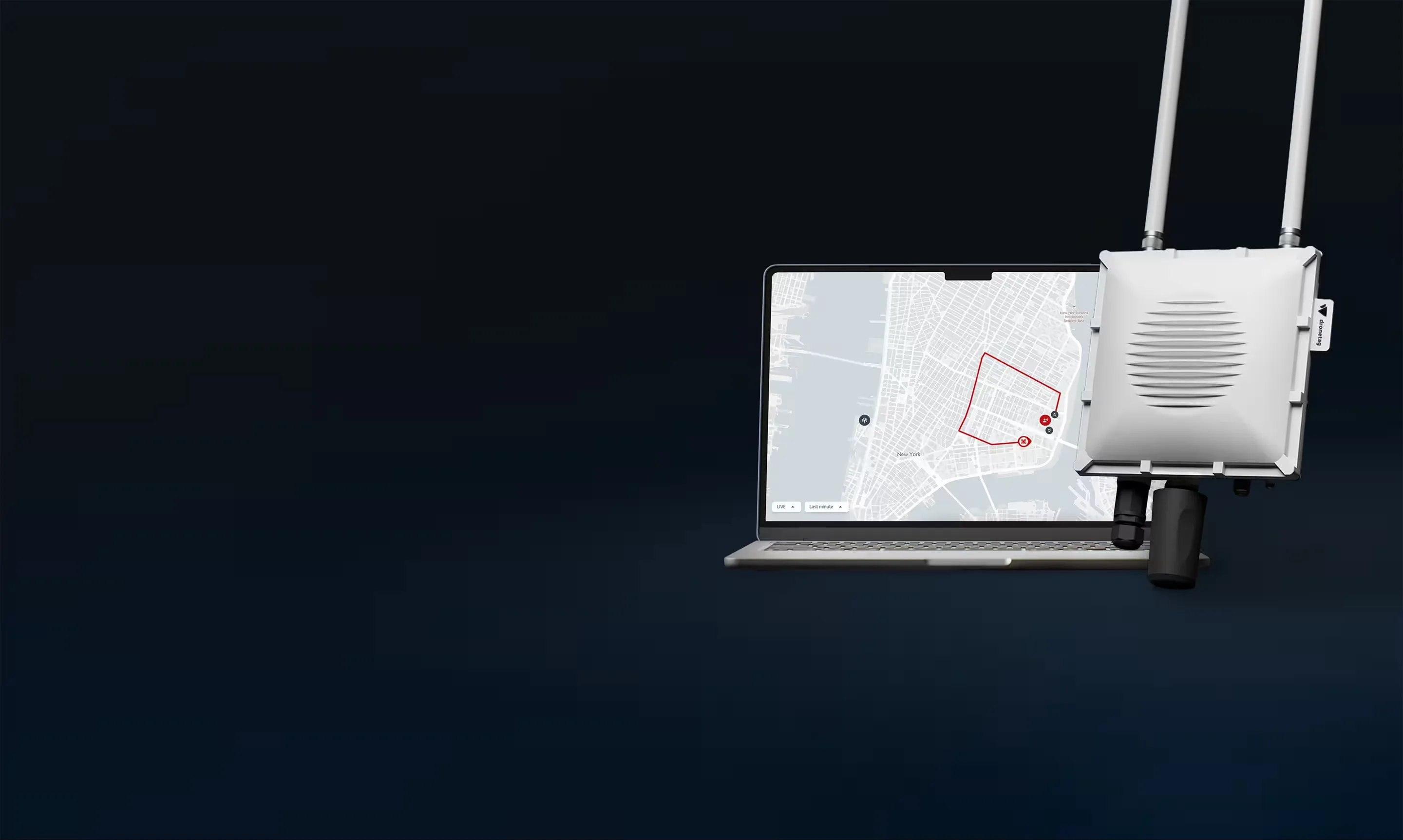
Know what's flying.
Before it becomes a problem.
Dronetag Remote ID receivers give security teams, law enforcement, and critical infrastructure operators real-time visibility of drone activity, pilot location, and flight intent in their airspace, without requiring any modification to the drone itself.
ATMOSPHERIC MONITORING
FROM THE AIR.
The Sniffer4D is a lightweight multi-gas and particulate sensor system designed to be carried by UAVs. It maps pollutant concentrations in three dimensions across large areas, providing high-resolution spatial data that ground-based monitoring networks cannot deliver.
Industrial Emissions
Quantify and map emissions from industrial facilities, construction sites, and energy infrastructure. Generate compliance-grade atmospheric data over large footprints without the cost of fixed sensor networks.
Urban Air Quality
High-resolution mapping of PM2.5, PM10, NO₂, SO₂, CO, and VOCs across urban areas. Identify pollution hotspots, model dispersion patterns, and inform public health and infrastructure decisions.
Environmental Assessment
Pre- and post-incident atmospheric assessment for emergency response, land development EIAs, and port or harbour operations. Deployable within minutes from any UAV launch point.
Book an Air
Consultation
Payload selection, regulatory compliance, pilot training, and full system integration. We scope it all.